Former Geographic Centres
of the European Union
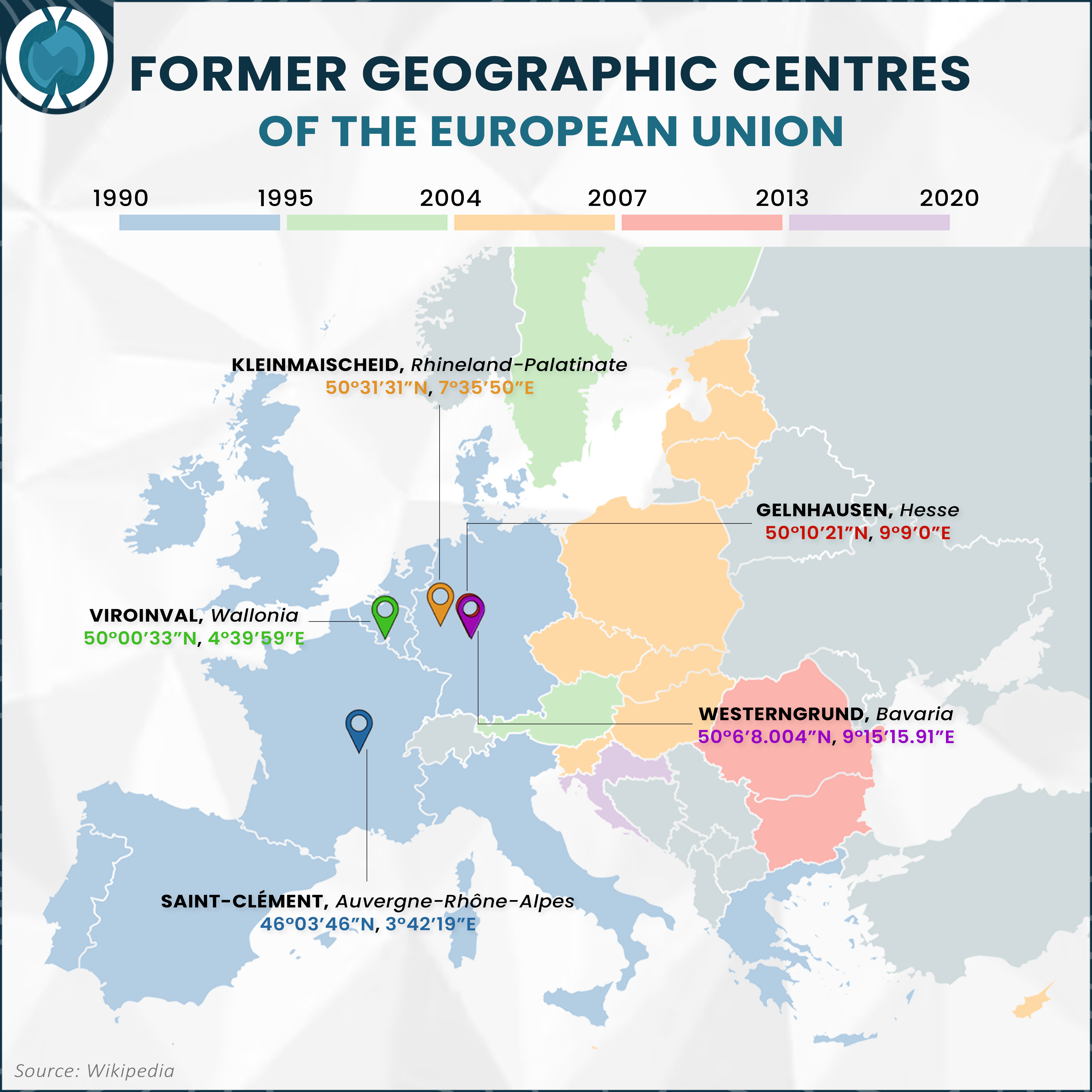
The geometric midpoint of the European Union originated in Saint-Clément, Auvergne-Rhône-Alpes in 1990, after the German reunification. The accession of Austria, Finland and Sweden in 1995 precipitated a distinct northeastward trajectory, relocating the centroid to Viroinval, Wallonia. A massive eastward stratification occurred in 2004 with the integration of ten nations including Poland, the Czech Republic, Hungary and the Baltic states, which shifted the center to Kleinmaischeid, Rhineland-Palatinate.
The trajectory continued its eastward drift following the 2007 annexations of Romania and Bulgaria, moving the focal point to Gelnhausen, Hesse. The centroid ultimately settles in Westerngrund, Bavaria (50°6'8.004''N, 9°15'15.91''E), elucidating the geopolitical gravity added by Croatia's entry in 2013 and before Brexit in 2020.
Locations and Coordinates of Former Geographic Centres
|
Years
|
Location
|
Subdivision
|
Country
|
Latitude
|
Longitude
|
|---|---|---|---|---|---|
| 1990-1995 | Saint-Clément | Auvergne-Rhône-Alpes | France | 46°03'46"N | 3°42'19"E |
| 1995-2004 | Viroinval | Wallonia | Belgium | 50°00'33"N | 4°39'59"E |
| 2004-2007 | Kleinmaischeid | Rhineland-Palatinate | Germany | 50°31'31"N | 7°35'50"E |
| 2007-2013 | Gelnhausen | Hesse | Germany | 50°10'21"N | 9°9'0"E |
| 2013-2020 | Westerngrund | Bavaria | Germany | 50°6'8.004"N | 9°15'15.91"E |