Land Reclamation in Monaco
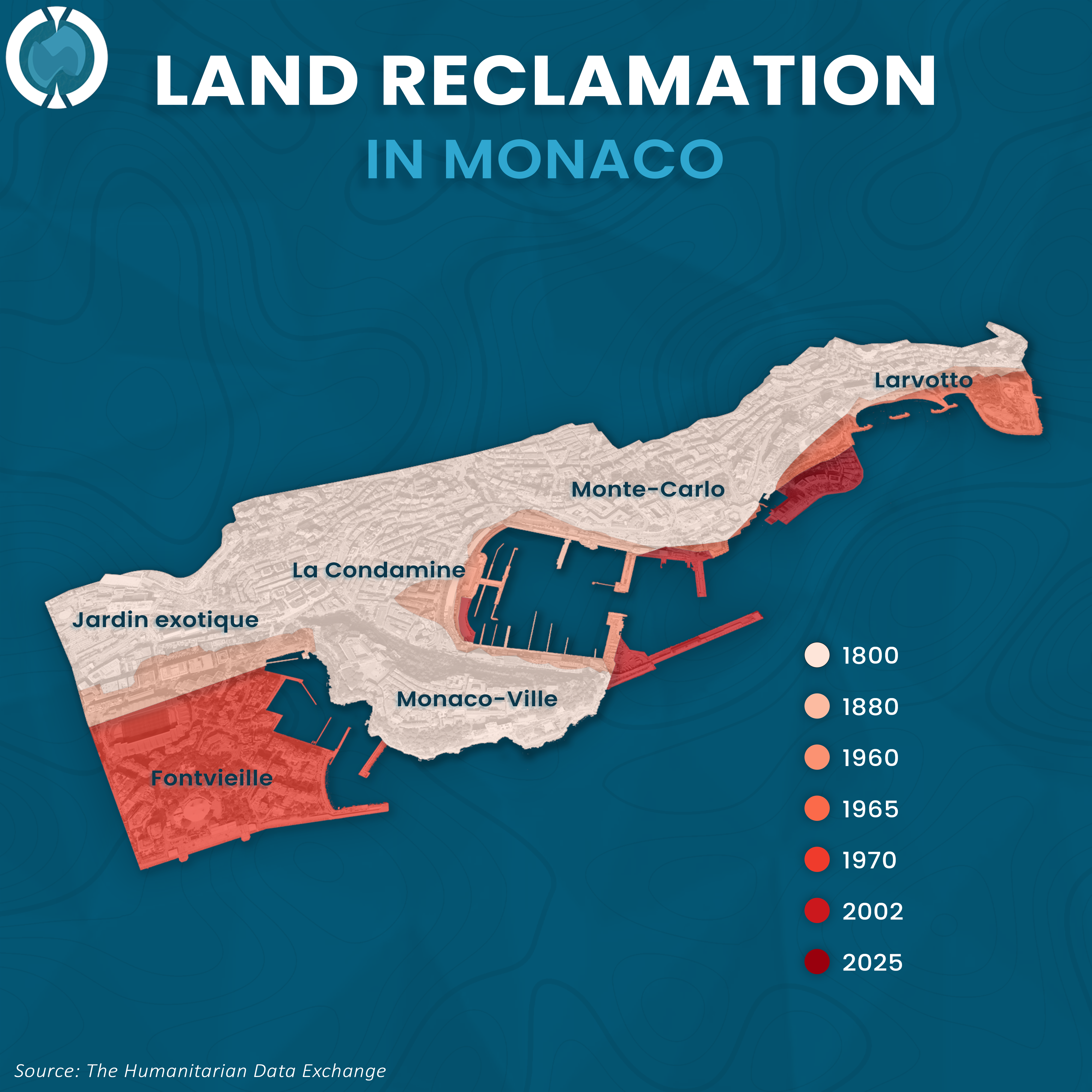
The principality’s geography delineates a 225-year timeline of artificial expansion, evolving from the original 1800 landmass to the projected boundaries of 2025. Fontvieille manifests as a dense consolidation of reclaimed territory, constructed primarily between 1965 and 1970 to dramatically extend the southwestern district beyond previous limits.
Conversely, the northeastern coastal zones near Larvotto and Monte-Carlo elucidate a modern engineering trajectory, with significant acreage added in 2002 and further seaward expansion targeted for 2025. These major developments dwarf the incremental changes seen in La Condamine during 1880 and 1960, underscoring a persistent strategy to overcome spatial scarcity through maritime construction.