War of the Pacific
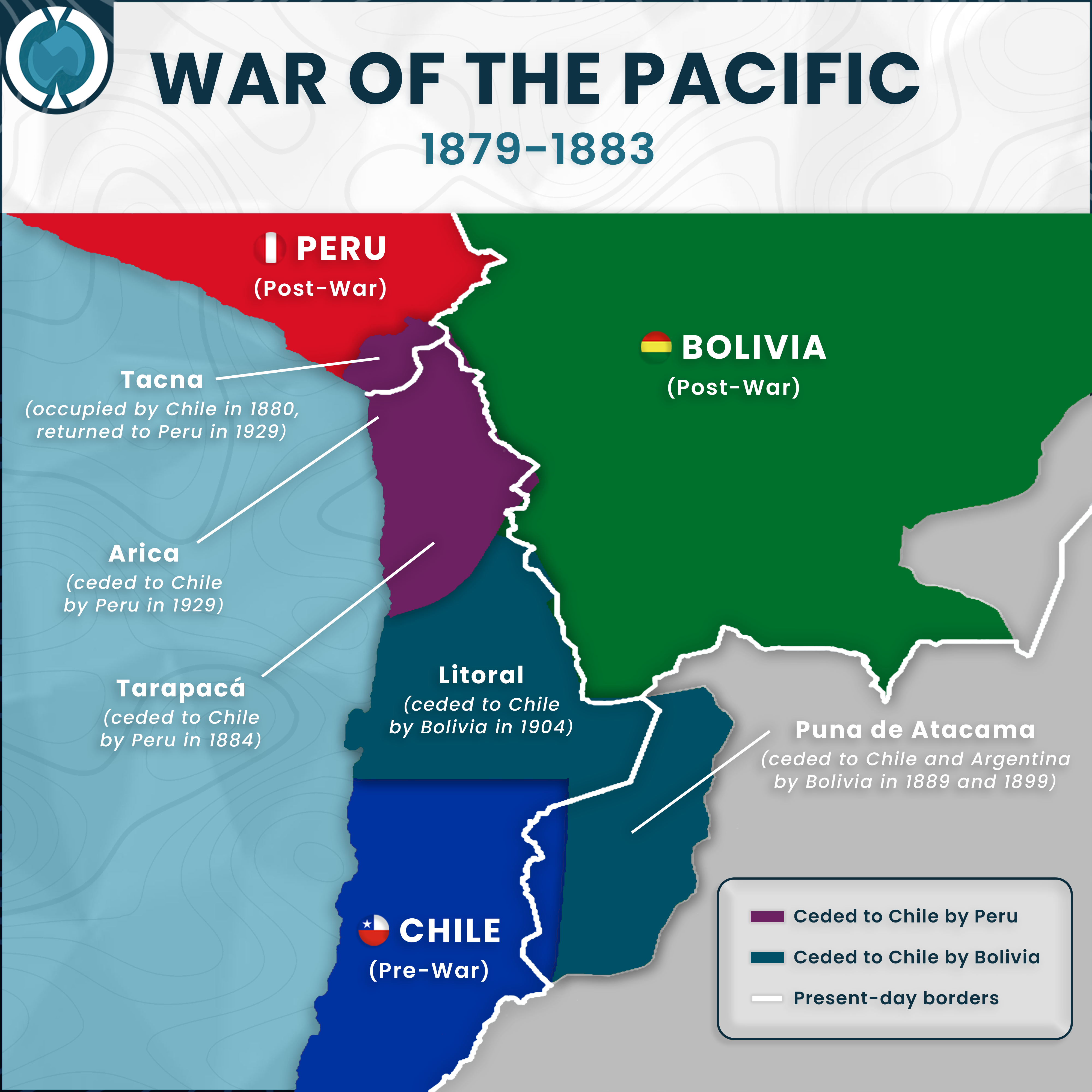
Geopolitical boundaries along the Andean coast underwent radical stratification following the War of the Pacific (1879–1883), resulting in a marked northward expansion of Chilean jurisdiction. Peruvian territorial administration diminished significantly, beginning with the cession of Tarapacá in 1884. Complex diplomatic resolutions regarding the Tacna-Arica dispute further delineate this shift; while Tacna returned to Peru in 1929 after an occupation commencing in 1880, Arica was permanently demarcated as Chilean territory in that same year.
Bolivian sovereignty concurrently suffered a critical reduction, elucidated by the permanent loss of the Litoral department in 1904, an event that consolidated the nation's landlocked status. Peripheral adjustments further defined the region's geography, as the Puna de Atacama was ceded to Chile and Argentina in staged transfers during 1889 and 1899. These territorial reconfigurations manifest a distinct dichotomy between pre-war borders and the modern political reality established by the early 20th century.